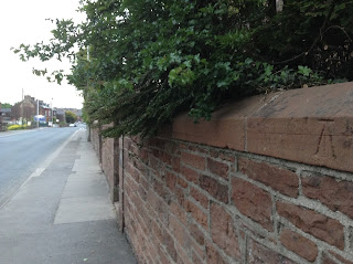
This morning's Watchtree running challenge for lockdown was to find benchmarks and trig points. The history of the mapping of the UK is fascinating. Working out the height above sea level was roughly done by starting at sea level, finding the angle upwards and the distance to the next fixed point, and then calculating the height gain. The precise point for the height was chiselled into a wall with an upward arrow to empasise it. The First Geodetic Levelling was between 1840 and 1860. This benhcmark on the wall of the old Quaker chapel dates from that time.
At this point, mean sea level was measured from Liverpool. They had a second go between 1912 and 1921 and a third go between 1950 and 1968. The third go used Flush Brackets, like these on St Mary's and St Cuthbert's
St Mary's also has what is called a Bolt
We found ordinary benchmarks that probably date from the original survey at Lessonhall
On the bridge at Waverbridge
On the milestone in Waverton
On the corner of New Street
And a couple of goes on the station bridge
There is also the trig point on the Silloth road above Waverbridge. I think this might be for mapping distances rather than heights - I'm not quite sure yet how they interact with benchmarks.


